The Andrews Valley-Binser Saddle Circuit
In mid November 2012 I tramped the classic Andrews Valley-Binser Saddle route. The
track is rated as easy-moderate, which I think relates to the distance
(36 km's total) rather than the difficulty of the track. Unfortunately
the weather was atrocious: rain, wind (80+ kph overnight)
and cloud made the conditions less than ideal.
 |
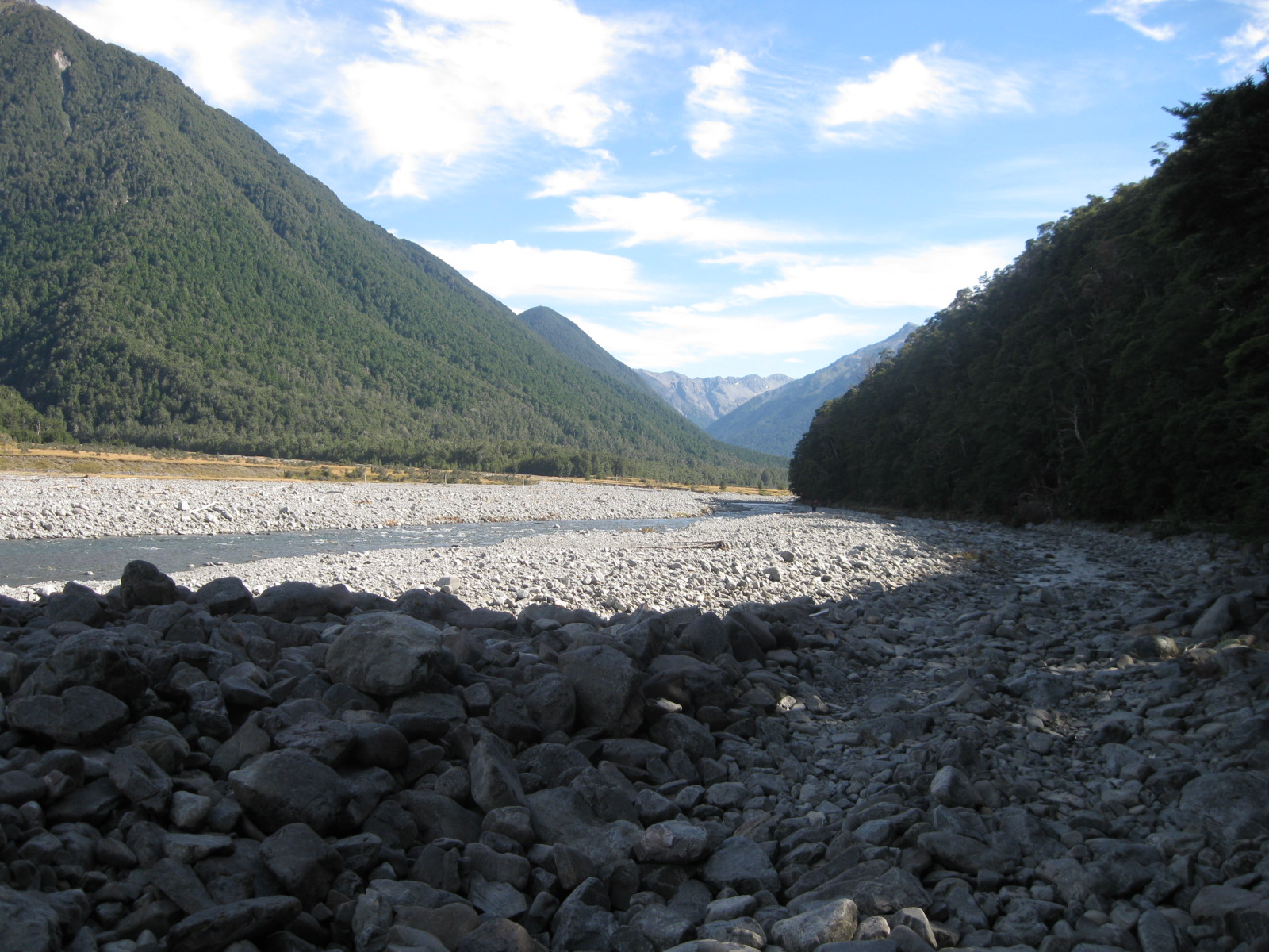
| View up Poulter Valley from the rise near Petes Stream |
The circuit Andrews Valley-Poulter-Poulter
Valley-Binser Saddle-Mt White Road is one of the few circuit tracks in
Arthur's Pass NP. It is also one which crosses no major rivers so is
safe in moderate rainfall conditions. There is an excellent route guide
for this track;
Casey-Binser Saddle Tracks.
I had three days of "lovely" New Zealand late spring weather, in other words, the theme for the trip was "WET"!
Day One: Andrews Shelter to Casey Hut; 16 kms, 6-7 hours
The
track from Andrews Shelter to Casey Hut is mostly in the bush, so this
protected me from most of the rain. The weather improved day by day, it
was clear and sunny weather for the last day.
 |
| Map: Andrews Valley-Poulter Valley area, Arthur's Pass National Park |
 |
| Car parking area near Andrews Shelter, Arthurs Pass National Park |
DOC timings for this track are out a bit, recommended time is 6 hours, I took 7 hours to get to the hut, probably because the weather packed in and made travel more difficult.
 |
| Interior of Andrews Shelter, Arthurs Pass National Park |
 |
| Andrews Shelter, at the start of the Andrews Valley Track |
The
car was left at Andrews Shelter, it is very basic, some bench seats, no
rain water or fire place but it does have a toilet. You could sleep in
the shelter if required but it would be cold and uncomfortable.
 |
| Start of the Andrews Valley track, next to the Mt White Road |
 |
| Pole Beech at the start of Andrews Valley |
The
track starts with a steep climb onto a spur, it then sidles it's way to
Hallelujah Flats at around the 800 metre mark for the next 2 hours.
 |
| Manuka scrub lining sides of Andrews Valley track |
 |
| Andrews Valley Track, this is about 1.5 hours in from the Mt White Road |
It
would be difficult to get lost following this track, but incredibly,
people have come to grief in this valley before. Personally, I found the
going fine, the track sidles in a band about a hundred metres up and
down for most of the way, not too strenuous.
 |
| Andrews Valley Track: A Wren that came to check me out |
If you did a right turn and walked off the track I can see how you could get lost, as it is quite thick but other wise....?
 |
| One of the side streams crossing the Andrews Valley Track |
 |
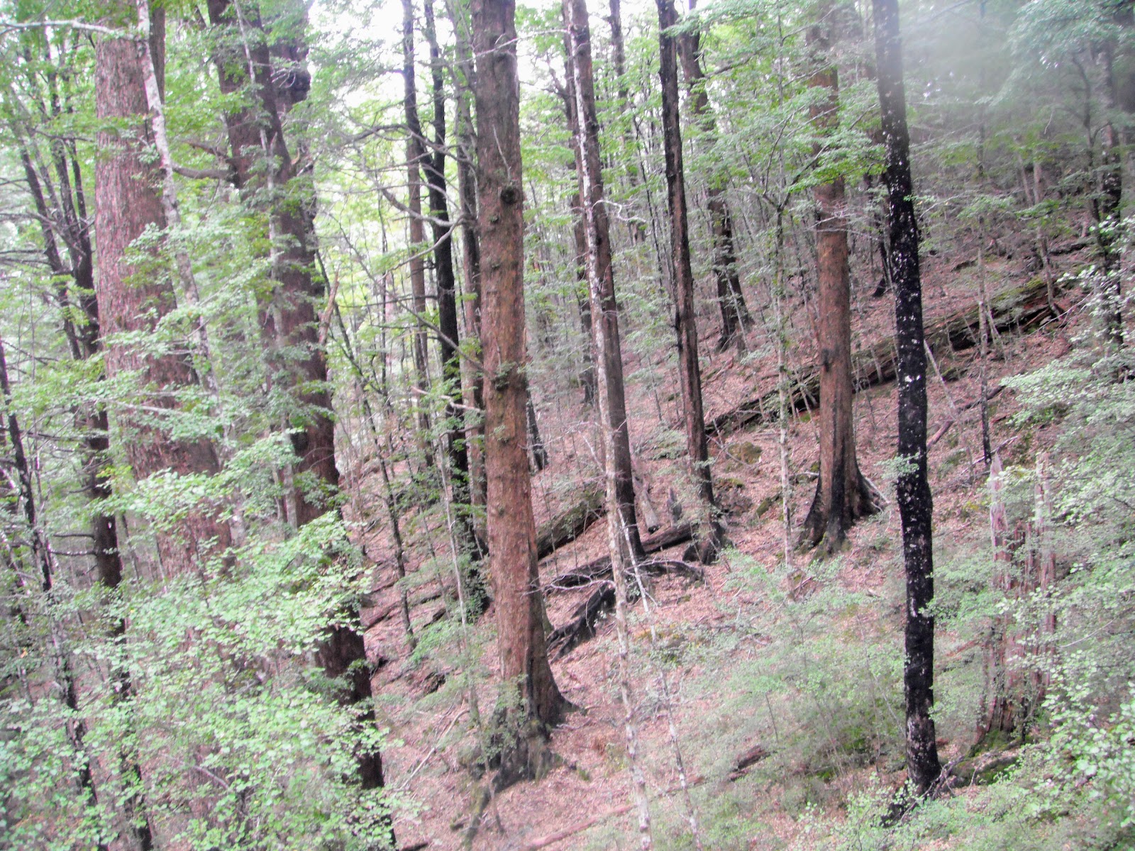
| Mature red beech trees, Andrews Valley Track, Arthurs Pass National Park |
 |
| Start of Hallelujah Flats, Andrews Valley |
Eventually
made it to Hallelujah Flat, aptly named I thought ( I certainly said
"Hallelujah" when I saw them!!!!). These flats extend for about 2-3 km's
with the track following close to Andrews Stream for most of the way.
The track is easy to follow, it obviously sees a lot of use.
 |
| Map: Hallelujah Flats and Casey Saddle, Arthur's Pass NP |
Hallelujah
Flat is an excellent place to camp, there is a lot of flat land, the
water is clean (no domestic animal access) and there is a bit of
firewood available.The best spots are at either end of the Flat, try to
camp on a slight incline so you dont get inundated if it rains.
 |
| View back down Andrews Valley, Casey-Binser Route, Arthurs Pass NP |
The flats took about an hour to traverse, then a stop for a soggy lunch
huddled under some beech trees! Nothing quite says New Zealand tramping
than a cold, wet lunch huddled under a tree with the smell of wet beech in the air. This is
the point that the rain started really coming down so I packed my camera
away.
 |
| Heading over Casey Saddle on the way to Casey Hut, Arthur's Pass NP |
 |
Casey Saddle, the Casey Saddle Track sidles along the spur to right,
photo from Scott Condron |
Past
Casey Saddle you need to ford Surprise and Trinity streams which will
be impassible in heavy rain. As it was they were both right on the edge
of safety for me crossing by myself, if I had come through an hour or so
later I would not have been able to cross.
The
last 2 hours are a climb up and over a spur, once over the spur it was a
long slow descent in the rain down to the river flat the hut is located
on.
 |
| Rest spot at unnamed stream near Pt 869, Casey Stream Track |
Finally made it to Casey Hut about 7 pm,
only 2 other occupants so plenty of room in this 10 bunk hut. It was a
pleasure to arrive and find an enormous fire blazing in the
woodburner...
Note:
Casey Hut burnt to the ground in late 2015. Current DOC plans do not
include replacing the hut, instead this will be a back country camp
site, possibly with a new cooking shelter. Various groups are trying to
encourage DOC to build a new hut here even if it is much smaller than
the original. Currently you will find a toilet and the old woodshed on
site, water is from the nearby stream.
 |
| Burnt out Casey Hut, 2016 from the TVNZ website |
The
closest hut is Trust Poulter about 1.5 hours further up valley,
inaccessible if there has been any rain as there are three streams to
cross en route.
Take a tent with you if you are considering walking this circuit.
See my further updates at the bottom of this post...
The interior shots below are from the Tramping New Zealand website.
 |
| Interior of Casey Hut showing bench area |
|
|
|
|
|
|
 |
| Bunk room in old Casey Hut, Arthurs Pass NP |
 |
| The awesome firebox in Casey Hut, Arthurs Pass NP |
I
shared the hut that night with two Kiwi women who had come in from
Andrews Shelter a couple of hours before me. They were on their way up
valley to
Lake Minchin
but unfortunately the heavy rain scuttled their plans as Casey Stream
was a swirling vortex of death. It hosed with rain overnight from 7 pm
right through to noon the next day.
I
had a meal of instant mash and corned beef fried into patties, oh man
it is good after a long hard day of tramping. After that it was reading
and tea before a well deserved sleep.
I had a whole bunk room to myself that night.
Day Two: Casey Hut to Pete's Stream; 10 kms. 3-4 hours
I stayed
in the hut the next morning drinking tea as the weather was terrible,
it was due to clear in the late afternoon. Casey Hut is magnificent, it
is one of the "Lockwood" style huts popular with the NZFS in the early
1980's, others include Hamilton Hut, Hope Kiwi, Hawdon Mark I, Edwards
and Goat Pass.
 |
| Casey Hut, Poulter valley, Arthur s Pass National Park... morning of day two |
These are far and away my favourite DOC huts. I love all that wood!
The weather cleared in the afternoon so I
started out at 2 pm, there were light showers on and off as progress
was made down the Poulter Valley. It was quite a hike, about 10km's and
took about 3-4 hours to reach the scratch camp sites near Pete's Stream.
 |
| Poulter Valley: walking through the red beech trees near Casey Hut |
Because of the rain I took few photos, my camera is not waterproof so I was concerned about water damaging it.
 |
| Poulter Valley: setting off down the river flats near Casey Hut |
 |
| Map: Poulter Valley...the long slog from Casey Hut, Arthurs Pass NP |
There are two significant
streams to cross: Mt Brown and Pete Stream's. I had no problems crossing
them but they could be a problem if it was raining hard, bear this in
mind when planning a trip up the Poulter Valley.
 |
| View of the terraces at Petes Stream, near Binser Saddle from Scott Condron |
My plan was to camp before Binser Saddle
so a camp was selected on the river terraces on the far side of Pete
Stream, around 6.30 pm. Pete Stream is the last reliable water point
between here and Andrews Shelter, so fill up before you start the climb.
There are a couple of scratch spots in the matagouri where you can
pitch your tent, well protected from the wind.
 |
| Poulter Valley: misting rain over the Poulter river from the terraces above Pete's Stream |
I stopped here as it was at
least another 3-4 hours to get back to the car and I didn't fancy
walking on an unfamiliar track in the dark.
 |
| Me inside my tent on the terraces above Pete's Stream, Poulter Valley |
I was frankly knackered by the
time I had my tent up and ready to go in the semi darkness. After a
couple of brews and some food I was feeling much better. I heard some
light rain and snow falling during the night but nothing too major...I
had an excellent nights sleep.
Day three: Pete Stream to Andrews Shelter; 10 kms, 4 hours
I was surprised to wake on the last day and see snow on the trees
towards Binser Saddle, but apart from the snow coating the trees it was a
nice clear day.
 |
| Pete Stream, Poulter Valley from near my camp site, morning day three |
When you look at a map of Binser Saddle it
doesn't look that bad but it is actually quite steep on both sides of
the saddle. You are either ascending or descending for the next three
hours.
 |
| Map: Petes Stream to Binser Saddle, the red cross is my camp-site on day two. |
I
set out to cross Binser Saddle around 7 am, it was 2 hours to the top
and 1.5 hour down the other side. I was surprised by how far it was, the
track sidles up and down through the forest for quite a way but only
has 600m of height gain over 6-7 km.
 |
| Binser Saddle Track, Arthur's Pass NP |
The track to the top is not too steep, just long, the track condition on the Poulter Valley side of the saddle is good.
 |
| Jon resting half way to Binser Saddle, Arthur's Pass National Park |
 |
| Binser Saddle Track, looking back downhill towards the Poulter Valley |
Lower
down you are travelling through areas of regenerating beech, kanuka and
manuka...there is a bit of pole beech so I'm thinking it is
regenerating forest. There are also a few stands of large red beech
trees as you get closer to the saddle itself.
 |
| Nearing the top of Binser Saddle, Arthurs Pass National Park |
Near
the summit there were patches of old growth and also a small amount of
snow on the ground. There is a small seasonal stream about 50 meters
from the saddle, this is the only water supply on the whole track.
 |
| Snow on trees, Binser Saddle Track |
 |
| Snow on the tree tops near Binser Saddle, Arthurs Pass National Park |
There
is a beautiful clearing at the top of the saddle which would be an
ideal place to camp. It had about 5 cm's of snow on it as I passed, but
you could see the potential there.
 |
| Binser Saddle Track just before the saddle, the stream is near here |
 |
| Map: Binser Saddle to Andrews Shelter, the last 30 minutes is a walk along the Mt White Road |
Half
way down the other side of the saddle was an excellent view of the Mt
White bridge area, as you can see the weather was great on the last
day.
 |
| View from the high point on Binser Saddle, down towards Mt White road, Waimakiriri River |
The
condition of the track from this point down to the Waimakiriri River
flats is very poor. It is steep & rutted with a lot of wind fall, it
really needs some TLC from DOC. It took me nearly and hour and a half
to cover about 2 kms of ground.
 |
| Binser Saddle from Mt White road, Arthur's Pass National Park |
After
another hour I made it to flat ground. There was the matter of a 4 km
walk back to the car on the Mt White station road, I found this to be
the most difficult part of the trip because I was quite tired by this
point. Next time, I would be tempted to park my car at the base of
Binser Saddle and then walk back to the Andrew Shelter start point, to
save this walk at the end.
 |
| Binser Saddle, doesn't look so bad....nek minit! |
Binser
Saddle is the V notch in the centre of the above photo, you sidle
through the forest and then work your way down the ridge running left to
right.
 |
| Binser Saddle is the middle of the V notch, Mt Binser to the right of photo |
Overall
a good trip, enjoyable even with the rain. I made a rookie mistake and
started out with a three day tramp, really I should have worked my way
up to a three day trip because I was seriously unfit. I think next time I
would start at the Binser Saddle end of the track and walk out through
Andrews Valley.
Access:
From off SH 73 drive along Mt White Road to Andrews Valley entrance
near Andrews Shelter, other exit is at base of Binser Saddle 4 kms along
Mt White Station Road
Track Times: 6-7 hours to Casey Campsite, 5 hours to Pete's Stream, 4-5 hours to Andrews Shelter via Binser Saddle
Hut Details:
Andrews Shelter, no bunks, no heating, toilet: DOC campsite on old
Casey Hut location, toilet and wood shed, water from nearby stream:
Scratch campsite on the river terrace overlooking Pete's Stream
Miscellaneous:
All streams on this circuit are un-bridged and may be impossible to
cross in a storm, long periods traversing flats which are prone to windy
conditions.
Update
2015: Casey Hut burnt to the ground in early 2015, there is no hut on
the site at this time so DOC recommend you take a tent and camp close to
the site. There is still a woodshed and toilet there.
2017 Update: DOC Canterbury did a assessment and decided that Casey Hut will NOT be replaced. This is likely to happen more often now that DOC are severely strapped for cash.
Plans
are afoot to move one of the the huts from the Upper Poulter Valley to
near the old hut site. It looks like Trust Poulter (8 bunks) will be
shifted sometime in 2017-2018 with a refurbishment and possible
enlargement. This work is being carried out by a volunteer group with
some assistance from DOC Canterbury.
 |
| Trust Poulter Hut in the Upper Poulter Valley, Arthur's Pass NP |
Update
2018: A new and intriguing message has appeared on the DOC web site for
Arthurs Pass. There is now a message saying that Casey Hut is to be
replaced in Mid 2018 after 4 years with no hut on the site. I can find
no other information so here's hoping it means a new or refurbished hut
is going to be moved to this location soon...