A short history of Arthur's Pass and the National Park
Here is a very short potted history of the Arthur's Pass area.
General Information:
Arthur's Pass (previously called Camping Flat then Bealey Flats is
a township in the Southern Alps of the South Island of
New Zealand. The township is the gateway for exploring both Arthur's Pass National Park and a vital road/rail link to the West Coast of the South Island.
 |
| SH73 passing through Arthur's Pass township |
Arthur's Pass township is about 5 km
south of the mountain pass with the same name. The town is located 153 km (
2-hour drive) from Christchurch on SH 73. Its
elevation is 740 metres above sea level and is surrounded by 2000+ metre peaks and dense beech forest. The Bealey River runs
through the township.
 |
| Bealey River passing through Arthur's Pass Village |
A traditional Maori travel route
Arthur's Pass was one of the routes used by the indigenous Maori to cross the Southern Alps from Canterbury to the West Coast. The West Coast was a valuable food gathering location but the main resource Maori wanted was Pounamu or Greenstone. Greenstone was a prized material as it is hard and able to be turned into a variety of ornamental and practical tools. It was and still is found in several of the rivers on the West Coast side of the mountains
 |
| A ceremonial Maori Mere or Pounamu club |
In the event, Arthur's Pass was seldom used by Maori as there was an easier and faster crossing point using the Hurunui river to access the Taramakau Valley. This route is now known as Harpers Pass.
For much of the early European colonial period (1830-1860) the route over Harpers Pass was used if a person wanted to get to the West Coast.
For much of the early European colonial period (1830-1860) the route over Harpers Pass was used if a person wanted to get to the West Coast.
 |
| Looking down into the Taramakau Valley from Harpers Pass |
Gold fever strikes...a road is built
When a West Coast gold rush began in the mid 1860's, a committee of
Canterbury businessmen offered a £200 prize for anyone who could find a quicker route from Canterbury to
the West Coast. Arthur Dobson was tasked by the Chief Surveyor of Canterbury, Thomas Cass, to find out
if there was an pass out of the Waimakariri watershed
into valleys running to the West Coast.
A Māori Chief, Tarapuhi, told
Arthur of a rugged pass that hunting
parties occasionally used. In 1864, his brother Edward joined him and together they plotted a route to the Otira River. When Arthur returned to Christchurch, he sketched the country he had traversed and included it in a report to Cass.
 |
| The Dobson Memorial marks the exact spot East meets West on Arthur's Pass |
At the same time, Edward Dobson Snr (Arthur's
father) was sent to examine every other available pass between the watershed of
the Taramakau, Waimakariri and the Hurunui. After examining the head
of every valley he reported that "Arthur's" pass was by far the most
suitable for the direct crossing.
Starting in 1865 a coach route was surveyed, plotted, dug and in places blasted from Springfield in Canterbury all the way to Runanga on the West Coast. This was used for foot and horse bound transport most notably the Cobb and Co. stage line and was used right up to the early 1900's. It was a dangerous and demanding journey which could take from 4 days to two weeks depending on conditions.
 |
| A painting depicting the stage line over Arthur's Pass, in the Arthur's Pass Railway station |
A railway town...
The township, then named Bealey Flats was originally built as a construction village for the building of the Otira Tunnel,
which was started on 14 January 1908. Arthur's Pass township was reached
by the railway from Canterbury in 1914, while the Westland section advanced to Otira by 1916. Construction of the
tunnel was very slow due to lack of funds and World War One. The tunnel was finally completed in 1923.
 |
| Work starts on the Otira Tunnel in Arthurs Pass in 1909 |
The modern TranzAlpine Rail
Journey passes through Arthur's Pass and the Otira Tunnel as part of its 223
kilometres (139 mi) journey from Christchurch to Greymouth.
The trip is considered one of the world's great train journeys for the scenery
and views.
A power station was built below the Devil's
Punchbowl Falls to provide electricity for the tunnel construction and the
village itself.
 |
| Remains of the Otira Tunnel power station in 2018 |
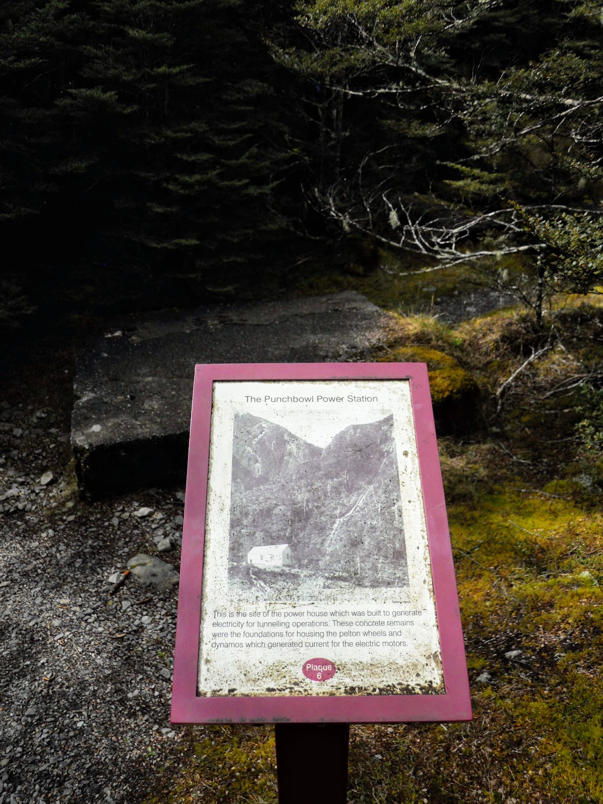 |
| Information board on the Arthur's Pass Historic Walk about the Punchbowl power station |
Creation of the National Park
In 1929 the Arthur’s Pass National Park was
created, it was New Zealand's third National Park. The park has always had a policy of minimal infrastructure as it was intended to maintain the alpine scenery in as pristine a condition as possible. Of interest to visitors were glaciers in both the Bealey and Otira Valleys as well as mountain climbing, valley tracks and the many waterfalls in the park.
From the 1930's till the mid 1980's the park was well used as a climbing/tramping destination by groups from Canterbury, as a result a number of early huts were built including the Waimakariri Falls, Anti Crow, Greenlaw and Park Morpeth huts. Most of the peaks were climbed early as the area is the most accessible climbing destination in New Zealand.
Over time various sections of land have been added to the original park mostly on the eastern side of the Great Divide. Arthurs Pass National Park remains one of the most visited national parks in the country and now has a profusion of short and long tracks, a ski field and over 30 DOC huts within its boundaries.
Arthurs or Arthur's...what's in a name?
The park and township was always unofficially named Arthur's Pass. However, the New Zealand Geographic Board had a strict policy of
omitting the apostrophe in place names, and the name was officially changed to
Arthurs Pass. This caused a great upset with the local population, and the
Minister of Lands reinstated the old version with the apostrophe. Since 16
September 1975, the post office also adopted the spelling with the apostrophe, Arthur's Pass.
 |
| Is that the right spelling of the name... |
Modern Facilities and attractions
The township has a DOC visitor centre,
which also accommodates a visitor information and an informative display room.
Visitor accommodation is provided, from camp grounds up to hotel standard. The
township provides a general store, a petrol station, tea rooms and restaurants.
There are also several good walks from the township,
including the Devil's Punchbowl Falls, Bealey Valley and
Avalanche Peak. The
mischievous Kea (New
Zealand mountain parrot) the worlds only Alpine Parrot can be found here.
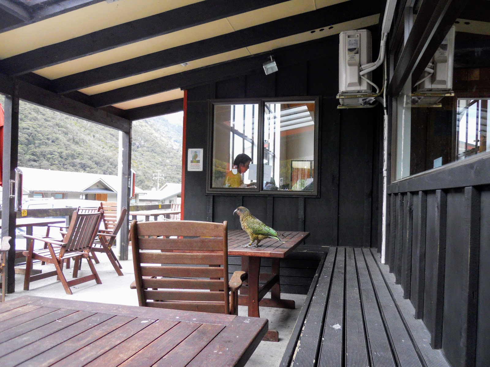 |
| A Kea or New Zealand Mountain Parrot at the Arthur's Pass General store |
The club skifield Temple Basin is
nearby and is a popular attraction through winter.
No comments:
Post a Comment